Tag Archives: Pyramids

Jawajska Przygoda od Piramidy Światła do Świątyni Tysiąca (a tour offered in Polish).

Archeologia wyspy Jawy wraz z wizytą na Bali. Organizator turystyki, który jest ospowiedzialny za przygotowanie wyjazdu to biuro Ex Oriente Lux – profesjonalny organizator tematycznych wycieczek do Azji.

Wyprawa indywidualna dla 6 – 10/15 osób (w zależności od zainteresowania). Okres wyjazdu: 19 lipca – 1 sierpnia (14 dni na miejscu) – wylot następuje w dniu 18 lipca, a powrót do Polski bedzie 2 sierpnia.

CENA PONIŻEJ

W ramach moich szerokich zainteresowań i studiów leży niewątpliwie archeologia i mitologia Azji Południowo-Wschodniej, szczególnie wydarzenia opiewane przez eposy Ramajany i Mahabharaty, ale także język architektury hinduistycznej i buddyjskiej.

Tym razem zapraszam na wycieczkę w świat bogów i demonów oraz ich architektonicznych siedzib, przez wieki uznawanych przez ludzi za sacrum a przez archeologów i historyków za zagadkę. A to wszystko w transcendencji baśniowych krajobrazów.

DZIEŃ 1: JAKARTA (18.07.23; lot z Warszawy w tym wypadku odbędzie się 17 lipca)

Witamy w Indonezji! Po wylądowaniu w DŻAKARCIE (zachodnia część wyspy Jawa) czekają Was procedury imigracyjne oraz odbiór bagaży. W hali przylotów będzie czekał na Was przewodnik oraz prywatny, klimatyzowany pojazd, którym wyruszamy w 3-4 godzinną drogę na południe, kierując się tym samym w stronę naszego hotelu. Droga wiedzie nas przez chłodny BOGOR, „miasto deszczu”, za sprawą najwyższego poziomu opadów w Indonezji (pada tu ponad 320 dni w roku!), nad którym majestatycznie góruje WULKAN SALAK. Następnie trasa prowadzi przez plantacje herbaty i rejon PARKU NARODOWEGO GUNUNG GEDE PANGRANGO o powierzchni 150 km2, skupionego na dwóch WULKANACHGEDE i PANGRANGO. Nie trudno zgadnąć, że to właśnie im Park zawdzięcza swoją nazwę. Widowiskową trasę urozmaicimy przerwą na posiłek, relaks w gorących źródłach oraz wizytą u stóp okolicznych wodospadów w okolicy Bogor (w zależności od czasu). Kolację zjemy w rejonie południowego podnóża wulkanu Gede, w przyjemnie chłodnym mieście SUKABUMI (ok. 100 km od Dżakarty), a noc spędzimy w niedużym, 3* hotelu SANTIKA HOTEL SUKABUMI z odkrytym basemen (Superior Room, 25 m2). To świetna baza wypadowa oraz znakomite miejsce, aby zregenerować się po długim dniu aklimatyzacyjnym.

*Free photo source

DZIEŃ 2: BANDUNG (19.07.23)

Po wczesnym śniadaniu czas na wykwaterowanie. Wyruszamy w 2-godzinną trasę do kompleksu megalitycznego GUNUNG PADANG (tłum. “Góra Światła” lub wymiennie “Góra Oświecenia”), którego odkrycie spowodowało sporo zamieszania w powszechnie znanej historii. Tarasy i dziedzińce kompleksu zbudowane są ze skalnych bloków i głazów o wadze 250-600 kg. Nie to jednak stanowi o niezwykłości tego miejsca. Otóż klejone starożytnym cementem ruiny zlokalizowane są na… wzgórzu stworzonym ludzkimi rękami! Archeolodzy dowodzą, że pod spodem kopca o kształcie piramidy czai się najstarsza konstrukcja wybudowana być może nawet 22 000 lat temu przez nieznaną cywilizację sprzed epoki lodowcowej! Oznacza to, że wyprzedziła ona pierwszą znaną cywilizację Mezopotamii o blisko 15 000 lat, a Göbeklitepe o 10 000 lat … Zapraszamy na spacer, który ukaże podobieństwo Gunung Padang do peruwiańskiego Machu Picchu, a także unaoczni rozległość terenu, który jest kilkakrotnie większy od świątyni Borobudur. Porozmawiamy również o kontrowersjach wokół Góry Światła – jak choćby o ofercie kupna praw do tego terenu wartej 1 miliard dolarów amerykańskich. Mówi się, że rząd Indonezji odrzucił tę propozycję licząc, że plotki o złocie ukrytym w piramidzie nie są jedynie plotkami. Gdy emocje nieco opadną, skierujemy się na lokalny lunch oraz w kierunku aktywnego WULKANU TANGKUBAN PERAHU (tłum. “Odwrócona Łódź”, ze względu na kształt góry), skąd rozpościera się oszałamiający widok na region BANDUNG. Następnie wizyta w kalderze wulkanu z wyjątkową panoramą krateru oraz (jeśli czas pozwoli) wizyta w kolejnych gorących źródłach w CIATER, aby odpocząć w ciepłej, siarkowej wodzie lub wizyta na lokalnym targowisku w miejscowości CIWDEY. Kolacja i nocleg w pobliżu KRATEROWEGO JEZIORA KAWAH PUTIHCIWIDEY VALLEY RESORT & HOT SPRING WATERPARK, BANDUNG (Superior Room, 25 m2).

*Photos from ‘Gunung Padang’, in Wikipedia. The Free Encyclopedia (2022).

DZIEŃ 3: KAWAH PUTIH (20.07.23)

Przed nami kolejne wczesne śniadanie, wykwaterowanie i wyjazd. Drogę umilą nam aromatyczne truskawki, „popisowy numer” tutejszych rolników. Na celowniku mamy KAWAH PUTIH (tłum. “Biały Krater”) ze swym emblematycznym jeziorem o wulkanicznym rodowodzie. Naszym zdaniem jego kolor bliższy jest turkusowi i może zmieniać się w zależności od zawartości siarki. W słoneczne dni kolor jeziora jest surowy i jasny, a w pochmurne cały krater może być spowity mgłą, co zapewnia równie niesamowite doznania. Niezależnie od palety barw hipnotyzujący widok uśpionego krateru jest jednym z najbardziej niezapomnianych przeżyć z Jawy. Posileni lunchem wyruszamy w stronę centralnej Jawy, do PEKALONGAN. 6-7 godzinną trasę pokonujemy klimatyzowanym pojazdem, rekompensując sobie w ten sposób brak połączenia lotniczego na trasie Bandung – Jogjakarta. Do Pekalongan docieramy wieczorem, w samą porę na pożywną kolację i nocleg w hotelu 3* SANTIKA PEKALONGAN (Superior Room, 22 m2), na skraju Morza Jawajskiego.

DZIEŃ 4: YOGYAKARTA (21.07.23)

Po śniadaniu wykwaterowanie i wyjazd z Pekalongan. Upewniamy się, że mamy pod ręką kurtkę przeciwdeszczową, ciepłą bluzę i czapkę, dzięki którym nagłe zmiany warunków atmosferycznych na wysokości 2 300 m n.p.m. nie będą bolesne. Kierowca zabiera nas w malownicze okolice płaskowyżu DIENG (tłum. “Siedziba Boga”), w którym zakochują się wszyscy miłośnicy przyrody. Droga urozmaicona meczetami, wioskami, tarasami ryżowymi na stromych zboczach, plantacjami owoców i warzyw zajmie nam ok. 2-3 godzin. Na dnie kaldery zobaczymy jedne z najstarszych indonezyjskich świątyń, które zostały odkryte przez archeologów w wyniku osuszania gigantycznego jeziora. To nie tylko najstarsze zabytki kultury jawajskiej, ale przede wszystkim jedno z najpiękniejszych miejsc w Indonezji! Mistycyzmu dodają mu aktywne wulkany, na których w VII w. zbudowano świetnie prosperujący, górski kompleks świątynny, o który dbali hinduscy kapłani i pustelnicy. Spędzimy czas nad JEZIOREM TELAGA WARNA, którego kolor wody zmienia się w zależności od czasu, pogody i perspektywy. Wspólnie polować będziemy na moment, w którym woda przybierze fenomenalną, szmaragdową barwę, bowiem o kolorach decyduje załamanie światła osadów siarki, które zalegają na dnie kolejnego, spektakularnego jeziora. Po przerwie na lokalny lunch wyruszamy do YOGYAKARTY (Jogjakarty) (4-5 godzin drogi) – kulturowego centrum wyspy. Zakwaterowanie w GALLERY PRAWIROTAMAN YOGYAKARTA (Deluxe Room, 35 m2), kolacja i odpoczynek.

*Free photo source

DZIEŃ 5: BOROBUDUR & BALLET SHOW (22.07.23)

Po śniadaniu dzień, na który wszyscy czekaliśmy z nutką ekscytacji. Przygotowujemy niewielkie plecaki, wodę oraz nakrycie głowy i wyruszamy na spotkanie z historią starożytnej Jawy. Główną atrakcją dnia są obiekty wpisane na listę światowego dziedzictwa UNESCO, czyli BOROBUDUR – największa na świecie świątynia buddyjska oraz pobliski PRAMBANAN – imponujący kompleks świątyń hinduistycznych, które swoją wspaniałością mogą konkurować nawet z Angkor Wat. Sąsiedztwo obydwu świątyń będzie przyczynkiem do rozmowy o harmonii i tolerancji. Opowieść rozpoczniemy od zaznajomienia się z nazwą „candi”, którą w języku indonezyjskim określa się świątynie hinduskie i buddyjskie. Candi Borobudur to świątynia z przełomu VIII/ IX wieku. W jej piramidalnej konstrukcji odzwierciedlona jest buddyjska wizja świata. Przez niektórych określany jako mistyczny – krajobraz kilkudziesięciu posągów Buddy, zamkniętych w stupach i ułożonych na planie mandali, którego tłem jest porośnięta dżunglą równina Kedu z wystającym na horyzoncie stożkiem wulkanu Merapi. Prambanan to hinduistyczny kompleks z IX w. Pierwotnie liczył 232 obiekty architektoniczne ułożone na planie trzech wielkich czworokątów, które zostały poważnie uszkodzone przez trzęsienie ziemi za sprawą wybuchu Merapi. Świątynie z Prambanan zniknęły wówczas na tysiąc lat, przysypane pyłem wulkanicznym. Porośnięte lasami czekały cierpliwie, bowiem dla bogów czas przecież nie istnieje. Mieszkańcy Jawy nie odważyli się ruszyć kamieni przez stulecia, bo wierzyli, że wszystkiego pilnują demony. Obejrzymy zatem największy i najbardziej znany kompleks hinduistyczny leżący poza granicami Indii. Posłuchamy o kulcie 3 bogów – Śiwie (Bóg Niszczyciel), Wisznu (Bóg Utrzymujący Świat) i Brahmie (Bóg Stworzyciel), analizując detale ozdobnych reliefów inspirowanych scenami z Ramajany – największego hinduistycznego eposu. Kolejnym przystankiem na tym samym obszarze będzie piękna, choć mało znana, królewska świątynia – CANDI SEWU (tłum. “Świątynia Tysiąca”), druga co do wielkości świątynia wyznawców Buddy na Jawie (tuż po Borobudur). Mówi się, że dawniej otoczona była ponad tysiącem mniejszych stup, stąd wzięła się jej nazwa, jednak archeolodzy doliczyli się 249 pomniejszych świątyń. Zajrzymy jeszcze do buddyjskiej świątyni CANDI PLAOSAN z IX stulecia, składającej się z dwóch bliźniaczych kompleksów. Legenda mówi, że tłem powstania Plaosanu było wielkie uczucie pomiędzy hinduskim księciem i buddyjską księżniczką, których do końca życia nie rozdzieliła religia. Wejścia do świątyni strzegą 4 potężne postacie, przypominające uzbrojone ogry – to wojowniczy dvarapala, czyli strażnicy drzwi lub bramy, dość powszechny element architektoniczny w kulturze hinduskiej i buddyjskiej. W zależności od wielkości i zamożności świątyni strażników ustawiano pojedynczo, w parach lub w większych grupach. Mniejsze budowle mogły mieć tylko jednego dvarapala. Po lunchu czas na ostatnią świątynię na naszej dzisiejszej trasie. Niewielka w porównaniu z Borobudur, buddyjska CANDI MENDUT, szczyci się trzema 3-metrowymi posągami. Wewnątrz ruin z chłodnego mroku wyłonią się trzy monumentalne rzeźby przedstawiające mistyczne ciała Buddy – sami wówczas zobaczycie, że Cewi Mendut jest niesłusznie omijana przez odwiedzających, ponieważ tutejsze rzeźby są arcydziełami na światową skalę. Wieczorem zapraszamy na kolację z set menu (18:30) oraz na wyjątkowy spektakl, który odbędzie się w amfiteatrze pod gołym niebem (w okresie pory suchej, czyli maj – październik; obowiązują 3 klasy biletowe; 19:30 – 20:30). Na naszych oczach odegrany bedzie taneczny dramat RAMAJANA BALLET – czyli interpretacja sanskryckiego eposu „Dzieje Ramy” o indyjskich korzeniach. Godzinne przedstawienie to znakomite połączenie choreografii, muzyki i zachwycających kostiumów blisko 200 tancerzy. Tancerze i aktorzy wystąpią dla nas na tle oświetlonej świątyni Prambanan. By mieć pewność, że nie poczujecie się zagubieni, przed rozpoczęciem spektaklu nakreślimy jego fabułę, a także podpowiemy na co zwrócić szczególną uwagę. Druga noc w GALLERY PRAWIROTAMAN YOGYAKARTA (Deluxe Room, 35 m2) i czas na regenerację po aktywnym dniu.

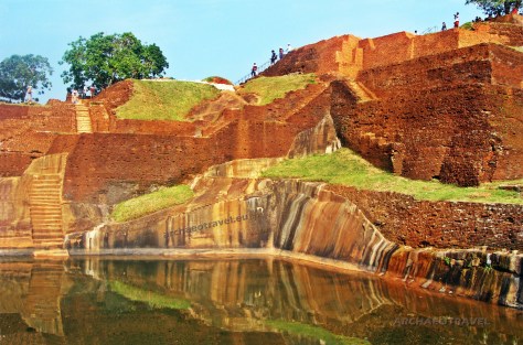
DAY 6: ŚWIĄTYNIA RATU BOKO & CANDI CETO (23.07.23)

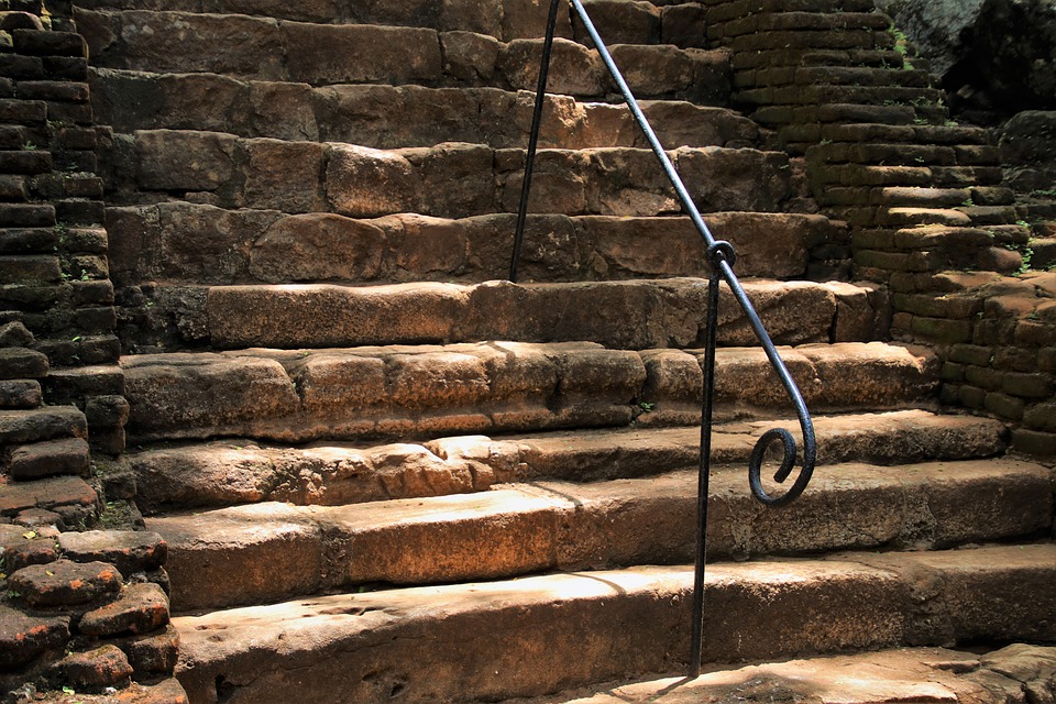
Po śniadaniu wykwaterowanie i przejazd do ruin RATU BOKO, których funkcja do dziś pozostaje zagadką. Niektórzy eksperci sądzą, że miejsce miało character religijny, inni zaś upatrują w nim ufortyfikowany pałac królewski z wyraźną pozostałością murów obronnych. Dzięki położeniu na zboczu wzgórza rozpościera się stąd piękna panorama Prambanan i WULKANU MERAPI – tło, które aż się prosi, by uwiecznić je na zdjęciach. Wyruszamy na zachód wyspy, w kierunku CANDI CETO. Po drodze postój na lokalny lunch, następnie około 3 godz. drogi z okazją do degustacji tutejszych owoców egzotycznych. Uprzedzamy, że droga do jawajsko-hinduskiej świątyni Candi Ceto jest wymagająca – złośliwi mówią, że tylko dla ludzi o mocnych nerwach, bo pnie się stromo w górę wzdłuż wysokich klifów. Pora przyodziać się w coś cieplejszego, bo Candi Ceto wzniesiono na zboczu STRATOWULKANU GUNUNG LAWU, na wysokości blisko 1 500 m n.p.m. Świątynia do złudzenia przypomina obiekty, które znać możemy z Bali. Dysponuje kilkoma tarasami, z których najwyższe są niedostępne dla odwiedzających, bowiem Candi Ceto wciąż pozostaje aktywnym miejscem kultu religijnego. Warto pamiętać, że Gunung Lawu stanowi także umowną granicę pomiędzy Centralną a Wschodnią Jawą, którą przekroczymy już jutro. Nocleg w SUKUH COTTAGE NEAR CANDI SUKUH (Standard Room, 16 m2).

*Free photo source

DAY 7: ŚWIĄTYNIA CANDI SUKUH & MT. BROMO (24.07.23)

Stałym zwyczajem tuż po śniadaniu wykwaterujemy się, będąc gotowi do drogi w stronę pobliskiej, hinduistycznej świątyni CANDI SUKUH, określanej mianem „erotycznej świątyni”. Ukryta w lesie, pozwoli nam odbyć krótki trekking nim dotrzemy do piramidy z grubo ciosanego kamienia, która przywodzi na myśl budowle Majów z terenów dzisiejszego Meksyku i Ameryki Centralnej. Przed nami trzypoziomowa architektura z XV w. ulokowana na zachodnim zboczu góry Gunung Lawu. Zagadkowa, odizolowana świątynia słynie ze swych płaskorzeźb, na których większość postaci jest naga od pasa w dół. Genitalia są przedstawione na kilku posągach, co jest dość rzadkie wśród klasycznych zabytków jawajskich. Niektórzy tłumaczą to historią powstania świątyni. Była ona bowiem wybudowana w czasie, gdy na Jawie toczyły się walki o władzę między muzułmanami, którzy zajmowali północ wyspy, a hindusami, którzy przeważali na południu. Miecze i penisy miałyby symbolizować hinduistyczne zwycięstwo z powodu większej męskości. „Erotyczna świątynia” będzie głównym tematem rozmów podczas lunchu, natomiast tuż po nim wyruszamy w długą drogę do aktywnego WULKANU BROMO – jednego z najsłynniejszych wulkanów w całej Indonezji. Zajmie nam to ok. 7-8 godz., które urozmaicimy historiami o starożytnej i dzisiejszej Jawie. Zmieniający się krajobraz umili nam najdłuższy z transferów na naszej trasie. Dzisiejsza noc będzie krótka, ze względu na wczesną pobudkę i obserwowanie wschodu słońca nad Bromo, dlatego po kolacji zachęcamy do porządnej regeneracji. Zakwaterowanie i kolacja w CEMARA INDAH HOTEL NEAR MT. BROMO (Standard Room, 18 m2), możliwie najbliżej punktu startu jutrzejszej eskapady.

DAY 8: WSCHÓD SŁOŃCA NAD WULKANEM BROMO (25.07.23)

Przygotowani na chłód i wiatr, wyruszamy już o 3:00 – 3:30. Mrok nocy przecinają wiązki światła naszych samochodów terenowych. Kierujemy się do PARKU NARODOWEGO BROMO TENGGER SEMERU, a dokładniej w stronę zbocza Mt. Penanjakan, do najpopularniejszego punktu widokowego. Czeka nas krótki, acz intensywny spacer z latarkami lub czołówkami z parkingu do najwyżej położonego punktu widokowego “King Kong Hill” (ok. 15 min) lub „Seruni Platform” (mniej popularnego). Warto być jednak przygotowanym na nieprzyjemne warunki atmosferyczne, przede wszytskim chłód. Już za moment niebo zacznie płynnie zmieniać kolory, szykując dla nas jeden z popisowych spektakli Matki Natury. Z ciemności wyłonią się kolejno trzej kompani – WULKAN BATOK (2 470 m n.p.m.), BROMO (2 329 m n.p.m.), SEMERU – najwyższy szczyt Jawy (3 676 m n. p. m.) oraz kilka mniej popularnych wulkanów i kalder znajdujących się na terenie parku. Z każdą minutą ich zbocza będą mienić się coraz cieplejszymi barwami. Uroku temu pocztówkowemu krajobrazowi dodaje położenie Bromo. Wulkan znajduje się wewnątrz masywnej kaldery Tengger (krater wulkaniczny o średnicy około 10 km), otoczonej morzem jasnego piasku wulkanicznego. Nim oddalimy się w stronę hotelu i śniadania, przejedziemy w pobliżu krawędzi Bromo, a chętni będą mogli przespacerować się po wulkanicznym pyle i wykorzystać poranne światło do fantastycznych ujęć. Uwaga: najlepszą przejrzystość powietrza i szansę na podziwianie panoramy Parku Narodowego niesie ze sobą okres od kwietnia do października. Wracamy do hotelu, aby sprawnie zjeść śniadanie, spakować bagaże i wyruszyć na lotnisko w Surabaya (ok. 4 godz.), skąd odlecimy do Denpasar (Bali). Po drodze przerwa na lunch lub posiłek na lotnisku (w zależności od zapasu czasu). Pożegnanie z polskojęzycznym, jawajskim przewodnikiem i check-in na przelot na Bali – wyspę, o której mawia się, że zagęszczenie świątyń to 4 budowle na 1 kilometr kwadratowy! Lądujemy na BALI, odbieramy bagaże i witamy się z kolejnym polskojęzycznym przewodnikiem. Kierujemy się wspólnie do komfortowego, kameralnego hotelu SOL BENOA BY MELIA 4* (Sol Room, 50 m2) z dostępem do dość szerokiej plaży ze złotym piaskiem. Trasa do hotelu zajmie nam ok. kilkunastu minut dzięki niedawno wybudowanej, płatnej drodze ekspresowej. Kolacja we własnym zakresie – w hotelu, w jednej z pobliskich restauracji lub w punktach ze street-foodem do których z łatwością można dotrzeć pieszo wybierając się na spacer poza kompleks hotelowy. Uwaga: w przypadku zmian w programie lub jeśli wyda się to Wam zasadne, na Wasze wyraźne życzenie możemy wykupić pakiet all-inclusive 24/7. Pakietu nie możemy rezerwować na wybrane dni, może obowiązywać wyłącznie przez cały czas trwania zakwaterowania.

*Free photo source

DAY 9: BALI HIGHLIGHTS (26.07.23)

Wczesne śniadanie oraz spotkanie z przewodnikiem, który porwie Was w drogę na północny zachód Bali oraz na kolację i zakupy w UBUD. Przed nami kolejny, intensywny dzień. Na początek ok. 2 godz. trasy wiodącej przez wioski i zielone tarasy ryżowe. Prawie na pewno napotykamy przynajmniej kilka procesji religijnych (pogrzeb, ślub lub cykliczne lokalne ceremonie) – szybko przekonacie się wówczas, że Bali jest jak jeden wielki plener fotograficzny! Odwiedzimy PURA BESAKIH na zboczu świętej GÓRY AGUNG, zwaną „Matką Wszystkich Świątyń”. Ze względu na to, że jest to najważniejsza świątynia, celebrowane są tutaj liczne święta – około 70 w ciągu 210 dni balijskiego kalendarza. Znajdziemy się na wysokości ok. 1000 m n.p.m., aby zwiedzić cześć z zespołu 23 świątyń i mniejszych sanktuariów. Najważniejszym miejscem jest PURA PENATARAN AGUN LEMPUYANG, do której można się dostać po pokonaniu wysokich schodów i przejściu przez “candi bentar” (rozszczepioną bramę). Przyjrzymy się ołtarzom dedykowanym hinduistycznej trójcy – Trimurti. Ołtarze udekorowane są na różne kolory odpowiadające konkretnemu bóstwu. Biały to kolor Sziwy, czerwony Brahmy, a czarny Wisznu. Następnie pora na górzysty region KINTAMANI z emblematycznym, masywnym wulkanem i KRATEREM BATUR, jeziorem o tej samej nazwie i okolicznymi dolinami. Jeśli pożywny lunch i aromatyczna kawa z tutejszej plantacji, to koniecznie z widokiem na wulkan! Zatrzymamy się w malowniczej wiosce na krawędzi krateru na szereg balijskich specjałów i kolejną porcję zdjęć. Po ok. 1 godz. przejździe znajdziemy się w pobliżu Ubud, a dokładniej mówiąc w GUNUNG KAWI  – kompleksie grobowców i świątyń rodem z XI wieku. To jedno z najbardziej fascynujących stanowisk archeologicznych na Bali. Otoczone polami ryżowymi, częściowo pochłonięte przez dżunglę, sprawia wrażenie opuszczonego i niedostępnego miejsca. Gunung Kawi obejmuje grupę 9 królewskich nagrobków, wykutych w skalistych klifach po obu stronach wąwozu świętej rzeki Pakerisan (która dalej niespiesznie płynie do świętych źródeł wody w pobliskiej świątyni TIRTA EMPUL, jednej z najsłynniejszych i nie bez kozery najładniejszych miejsc na wyspie). Zobaczymy je pod warunkiem pokonania 370 schodów, które doprowadzą nas do zacisznego miejsca pośród skał. Tu bije ogromna energia niosąca ze sobą harmonię. Przed wejściem na teren kompleksu mija się szpalery sklepików z całym swym dobrodziejstwem – wygospodarujemy nieco czasu na zakupy, na które pojawi się także szansa w Ubud. Pół godziny później jesteśmy już w leśnym parku „Monkey Forest Sanctuary”, na spacerze w towarzystwie zuchwałych makaków. Pilnując okularów i plecaków niespiesznie maszerujemy do XIV- wiecznej świątyni DALEM AGUNG PADANGTEGAL, wzniesionej ku czci bogini śmierci, Durgi. W międzyczasie pojawią się kolejne okazje do zakupu rękodzieła (m. in. wiklinowych torebek, łapaczy snów, kadzideł, ubrań i dodatków) w sklepikach z mydłem i powidłem oraz na pchlim targu w Ubud. Czas wolny warto przeznaczyć na samodzielną kolację w wybranej przez siebie (lub rekomendowanej przez nas) restauracji, następnie wspólny spacer przez Ubud w stronę naszego pojazdu. Po zmroku wracamy do hotelu SOL BENOA BY MELIA 4* (Sol Room, 50 m2).

DAY 10: CZAS WOLNY (27.07.23)

Dzień, który zawsze niesie ze sobą wiele frajdy – czas wolny, który można spędzić we własnym stylu. Awanturnikom i niespokojnym duchom pomożemy zorganizować dodatkową, indywidualną wyprawę np. całodzienną eskapadę na słynną wyspę NUSA PENIDA z okazją do snorklowania i plażowania; CEREMONIĘ OCZYSZCZENIA w wybranej, balijskiej świątyni; wyprawę w okolicę UBUD, by przespacerować się przez tarasy ryżowe i spędzić dzień w Jungle Beach Barze; masaż i zakupy w modnych dzielnicach Bali. Lunch i kolacja we własnym zakresie. Kolejna noc w hotelu SOL BENOA BY MELIA 4* (Sol Room, 50 m2).

*Free photo source

DAY 11: PODRÓŻ NA FLORES & LABUAN BAJO (28.07.23)

Kolejna zmiana adresu. Dzień rozpoczynamy śniadaniem w hotelu, wykwaterowaniem i przejazdem na lotnisko w Denpasar. Stąd o 10:20 wyruszamy w rejs liniami Batik Air do LABUAN BAJO na wyspie FLORES (czas przelotu ok. 1 godz.; możliwe są późniejsze połączenia, aby wykorzystać czas na Bali), meldując się na miejscu już o 11:30. W trakcie całej podróży towarzyszy polskojęzyczny przewodnik. Przejazd na lunch z zimnym piwem oraz check-in w hotelu w Labuan Bajo. Czas wolny na basenie, na plaży lub w mieście. Samodzielna kolacja w restauracji hotelowej lub poza miejscem zakwaterowania. Zakwaterowanie w PURI SARI BEACH HOTEL 3* z bezpośrednim dostępem do plaży.

DAY 12: KOMODO NATIONAL PARK – CZĘŚĆ 1 (DLA CHETNYCH – DODATKOWO PLATNE) (29.07.23)

Po śniadaniu wyruszamy na prywatną eksplorację PARKU NARODOWEGO KOMODO – jednego z najbardziej oryginalnych, a przez to najciekawszych parków we wschodniej Azji, nie na darmo wpisanym do „7 Nowych Cudów Natury”. Zobaczymy wszystkie miejsca, które przyciągają turystów z całego świata niczym magnes, pamiętając przy tym, że na PN Komodo składa się aż 30 wysp! Przygotowujemy ręczniki, stroje kąpielowe i kremy z filtrem, łapiemy wiatr w żagle i cumujemy przy KELOR ISLAND, aby jeszcze przed słońcem w zenicie wdrapać się na tutejszy punkt widokowy dla wspaniałej, niemal katalogowej panoramy – na horyzoncie okoliczne wyspy, wszelkiej maści łodzie i turkusowa woda. Na dole czeka na nas poczęstunek oraz czas na pierwsze snorklowanie. Uwaga: podłoże jest kruche I kamieniste, dlatego podczas wspinaczki przydadzą się zakryte, dobrze trzymające buty sportowe z bieżnikiem. Nim zrobi się okrutnie gorąco, a my poczujemy się jak w terrarium, cumujemy przy słynnej RINCA ISLAND, jednego z dwóch adresów waranów z Komodo. Wyruszamy w trwający blisko godzinę trekking po sawannie w towarzystwie lokalnych rangerów, aby na własne oczy spotkać endemiczne, 3-metrowe smoki z Komodo ze skórą niczym zbroja. Jak to z naturą bywa, możemy napotkać ich kilka lub wcale, ospałe lub aktywne. Na wyspie Rinca żyje ich ok. 1050 sztuk na 198 km2 (na Komodo ok. 1 700 sztuk na 390 km2; źródło: BBC 2020, dane na 2018 r., brak aktualnych danych na temat populacji w podziale na wyspy). Szlaki trekkingowe mają różne poziomy trudności i długość. Czas na schłodzenie się w orzeźwiającej, krystalicznie czystej wodzie, następnie lunch z przekąskami z grilla oraz zimne piwo na łodzi. Na kolację i nocleg wracamy do hotelu PURI SARI BEACH HOTEL 3* z bezpośrednim dostępem do plaży. Samodzielna kolacja w restauracji hotelowej lub poza miejscem zakwaterowania.

DAY 13: KOMODO NATIONAL PARK – CZĘŚĆ 2 (DLA CHETNYCH – DODATKOWO PŁATNE) (30.07.23)

Przed nami kolejny dzień na terenie PN Komodo, dlatego wypływamy skoro świt. Po najpiękniejszą panoramę regionu wyruszamy na PADAR ISLAND, przytulnie umiejscowioną pomiędzy Rinca a Komodo. Jest tu naprawdę bajecznie, a tej panoramy po prostu nie wypada przegapić. Wspinaczka zajmie nam ok. 20-40 minut, na szczyt wiedzie całkiem komfortowa, betonowa trasa ze stopniami i kamieniami. Nie ma roślin czy wzniesień rzucających cień, więc zawsze maszeruje się tu w pełnym słońcu. Po drodze pojawia się wiele punktów widokowych na których możemy poprzestać, ale te najbardziej spektakularne są na samym szczycie. Cumujemy przy niewielkiej wyspie KOMODO, gdzie na dość rozległym, leśnym terytorium (390 km2) żyje blisko 1700 waranów. To nasza drugie podejście na wypadek gdyby wizyta na Rinca skończyła niepowodzeniem, a Wami targały mieszane uczucia. Rezerwujemy czas na lunch, zdjęcia i snorklowanie na rafie przy PINK BEACH, której kolor nadają małe cząsteczki czerwonego koralowca. Przed zachodem słońca kierujemy się na wyspę Kalong, by pokazała nam kolejny cud Parku – zrywające się do lotu „latające lisy”, które o zmierzchu wyruszają na sąsiednie wyspy w poszukiwaniu jedzenia. Olbrzymia kolonia niegroźnych dla człowieka nietoperzy na tle wielobarwnego nieba wygląda jak wielka migracja ptaków. Na kolację i nocleg wracamy do hotelu PURI SARI BEACH HOTEL 3* z bezpośrednim dostępem do plaży. Samodzielna kolacja w restauracji hotelowej lub poza miejscem zakwaterowania.

Brama niebo przy świątynii balijskiej PURA PENATARAN AGUN LEMPUYANG z widokiem na wulkan o zmierzchu

*Free photo source

DAY 14: POWRÓT NA BALI (31.07.23)

Śniadanie w hotelu, wykwaterowanie i wyjazd w kierunku lotniska Labuan Bajo. W towarzystwie polskojęzycznego przewodnika lecimy do DENPASAR, na Bali (wylot rejsem linii Batik Air; czas przelotu: ok. 1 godz.), skąd kierujemy się na pożegnalny lunch. Wybraliśmy dla Państwa miejsce, które robi wrażenie tak na gościach, jak na nas samych. Beach bar z pięknym designem, smacznym jedzeniem, kolorową mieszanką gości – La Brisa Beach Restaurant Canggu w rejonie SEMINYAK, słynącego z dobrych restauracji, modnych barów i klubów. Dla chętnych czas na zakupy oraz 60-minutowy masaż ciała w PRANA SPA, który rozluźni Was przed podróżą. Transfer na lotnisko uzależniamy od ostatecznej godziny Waszego wylotu.

POŻEGNANIE Z GRUPĄ I PODZIĘKOWANIE ZA WSPÓŁPRACĘ

Wycieczka oparta na scenariuszu Archaeotravel.eu organizowana przez Biuro Podróży: Ex Oriente Lux dla 10 osób.

Wycena w grupie 10 osób wygląda następująco:

– 3750 USD za 1 osobę z uwzględnieniem Parku Komodo
– 2650 USD za 1 osobę bez uwzględnienia Parku Komodo

Obecnie na wyspie Rinca nie można korzystać ze szlaków trekkingowych, ale jest szansa zobaczyć warany w niedalekiej odległości od domku strażników. Tak czy inaczej okazja do oglądania waranów będzie miała miejsce jeszcze na wyspie Komodo, bo Państwa wizyta w Parku planowana jest na 2 dni.

W CENIE:

• Loty wewnętrzne (Surabaya – Denpasar; Denpasar – Labuan Bajo – Denpasar)

• Prywatny transfer klimatyzowanym pojazdem

• Polskojęzyczny przewodnik na Jawie

• Polskojęzyczny przewodnik na Bali

• Zakwaterowanie w obiektach kategorii 3* i 4*

• Wyżywienie full-board na Jawie (śniadanie, lunch, kolacja)

• Wyżywienie half-board na Bali (śniadanie, lunch)

• Spektakl Ramajany

• Masaż ostatniego dnia

• Butelkowana woda (2 x 0,5 l dziennie)

• Opłaty wstępu, niezbędne podatki

• Ubezpieczenie KL i NNW

POZA CENĄ:

• Wiza (pod warunkiem dalszego obowiązywania w lipcu 2023).

• Loty międzynarodowe

• Napiwki uznaniowe

Jeżeli chcesz do nas dołączyć, proszę o kontakt.

Unique Pyramid of Polonnaruwa with Little Trace in History

In my head I could still hear the noise of the airport, a commotion and rush at the customs control and at baggage claim, when I suddenly fell into the arms of tropical scenery, with its heavenly peace and tranquility given by the sound of the river and the whisper of huge leaves swaying in the wind. Hidden in the shadow of the tall boughs on the shore, I lazily observed a bright sunlight pouring profusely over the river and a group of elephants frolicking in it.

At first, I could not believe that I had become part of this picturesque image: in the background of a dense curtain of tall palm trees and thick creepers protruding from green ficuses and their trunks, heavily wrinkled bulks of elephants were wading in the silvery water of the river. Some turned over and poured water on each other, using their long trunks like watering cans.

Rhapsody for an elephant

Elephants have always been a very important national element of Sri Lanka and as such these animals have become part of the folklore and leading characters of Southeast Asian legends. Throughout ages, men in Asia have taken numerous advantages of elephants’ strength to create massive constructions, using the animals not only for dragging heavy loads and their transportation but also for military purposes. The aforementioned king of Sigiriya, Kashyapa (also Kassapa), was to take part in his last fight also on the back of an elephant (see: In the Realm of Demon Ravana).

Especially the white elephant with long tusks has always been of a great importance to both, Hinduism and Buddhism, where, as tradition says, it serves either as a mount for the Hindu god, Indra, or appears in a dream of the mother of Gautama Buddha, just before he is conceived. The white elephant is an equally significant symbol of the royal power in Sri Lanka. During the processions of religious festivals in Kandy, the king’s white elephants have driven a reliquary with the most venerated there a Buddhist relic, namely, the famous Buddha Tooth preserved to our times, and brought to the island in the fourth century AD. by Mahinda’s sister, Sanghamitta. The same relic had previously been also preserved in another ancient capital of Sri Lanka, Polonnaruwa, where it was possibly housed in the shrine of Hatadage.

Tired after the journey in the cramped seat of the plane, I was laying on the steps of the stairs leading down to the river, and I was watching a wonderful spectacle of playing elephants as if I had been in a daydream. But such a sweet laziness could not last forever. And after a short break in Pinnawala, a famous elephant orphanage on the island, we finally set off on the way to meet archaeology of one of the ancient capitals of Sri Lanka.

Gateway to the ancient city of Polonnaruwa

The ancient city of Polonnaruwa was first designed as a country residence before it became the successive capital of the Sinhalese kings, after the destruction of the former royal centre in Anuradhapura, in 993 AD. (UNESCO 2021; Brown D. Brown J. Findlay 2005).

In the foreground of the remnants of the Palace of the kings of Polonnaruwa. Copyright©Archaeotravel.

Actually, Polonnaruwa was designated as a capital by the Chola dynasty, who abandoned the previous one in Anuradhapura for strategical reasons (Brown D. Brown J. Findlay 2005; Wulff Hauglann 2020; Saumya 2020). In 1070 AD., it was, however, overtaken by Sinhalese kings who kept Polonnaruwa as their capital (Brown D. Brown J. Findlay 2005; Wulff Hauglann 2020; Saumya 2020). As a matter of fact, it was during the Sinhalese rule when the city’s glory reached its peak (Wulff Hauglann 2020; Saumya 2020). Among the greatest kings of that period was the second king who ruled the capital, namely King Parakramabahu the First, whereas the third one, the King Nissanka Malla (1187 – 1196) eventually led the kingdom to bankruptcy and so, in the early thirteenth century, the glory of Polonnaruwa had ceased (Brown D. Brown J. Findlay 2005; Wulff Hauglann 2020; Saumya 2020). Finally, it was abandoned, and the Sinhalese capital was moved to the western side of the island, to the city of Kandy, which became the very last capital of the ancient kings of Sri Lanka (Brown D. Brown J. Findlay 2005; Wulff Hauglann 2020; Saumya 2020).

Part of the Cultural Heritage Triangle of Sri Lanka

Together with two other historical capitals, Anuradhapura and Kandy, the city of Polonnaruwa creates one of the three angles of the pyramid-shaped graphic sign of the Cultural Heritage Triangle of Sri Lanka (Saumya 2020; see: In the Realm of Demon Ravana). As an archaeological and a UNESCO World Heritage site, Polonnaruwa comprises numerous monuments of different periods and functions; besides the Brahman ruins of the Cholas rule, from between the tenth and eleventh centuries, there are picturesque remnants of abundant Sinhalese constructions, built between the twelfth and thirteenth centuries, including a famous king’s, Parakramabahu the First, magnificent garden-city (UNESCO 2021; Brown D. Brown J. Findlay 2005; Wulff Hauglann 2020; Saumya 2020).

Unknown building among royal and sacred edifices

Almost all the constructions in the area of Polonnaruwa are historically recorded (Mohan 2019). Apart from earlier temples dedicated to Hindu gods, there are mostly secular buildings, like the Royal Palace and the Audience Hall, and Buddhist shrines, most famous of which are Dalada Maluva, including the Sacred Quadrangle with the unique Vatadage (Brown D. Brown J. Findlay 2005; Wulff Hauglann 2020; Saumya 2020), “where the Tooth Relic of Lord Buddha was housed” (Bell 1903:14-15 in: Manatunga 2009:2004), Lankatilaka Vihara and Gal Vihara (Brown D. Brown J. Findlay 2005; Wulff Hauglann 2020; Saumya 2020).

The Satmahal Prasada in Polonaruwa. The only feature that may give some insight into the origins of Sathmahal Prasada are sculpted statues. Nevertheless, their identity has been disfigured by intentional destruction. Copyright©Archaeotravel. Photo by Bernard Gagnon (2006). CC BY-SA 3.0. Photo source: “Satmahal Prasada” (2021). Photo source: Wikipedia. The Free Encyclopedia.

Nevertheless, there is no account of a pyramidal-like stepped edifice situated in an elevated area, which is generally perceived as the most mysterious structure of all in the whole ancient city and sometimes the only ancient pyramid in Sri Lanka (Mohan 2019; Manatunga 2009:2004; Lapkura 2021).

Named as Sathmahal Prasada

The structure has been named in modern times as Sathmahal Prasada, which literally means a seven-storey building (Mohan 2019). It is located in the proximity of the Vatadage and so it is included within the Buddhist complex of Dalada Maluva (Brown D. Brown J. Findlay 2005; Wulff Hauglann 2020; Saumya 2020). This is why Anura Manatunga (2009:204) thinks it was also build for religious purposes  as other constructions on site. For this reason, Sathmahal Prasada is believed to have served as a stupa, built in the proximity of other prominent Buddhist ruins such as stupas and monasteries of Polonnaruwa (Lapkura 2021).

As much as the Quadrangle may have played the role of the most important royal monastery of Sinhalese kings ruling in the city, Sathmahal Prasada must have had a very significant function as well (Manatunga 2009:204). Yet, the pyramid may not have belonged to the Buddhist complex originally (Mohan 2019). And as Anura Manatunga (2009:204) admits the construction “is still unidentified and remains an ambiguous monument [as] we cannot [pinpoint its] builder, purpose or even the ancient name of the building”.

Accordingly, experts do not know who built it or why it was built (Mohan 2019; Manatunga 2009:204; Lapkura 2021). Its original name is equally lost in history (Mohan 2019; Manatunga 2009:204). As such, it can be described only by means of its appearance and it actually resembles a stepped pyramid with entrances on all four sides (Mohan 2019; Lapkura 2021). Moreover, it is also one of no more than four other ancient constructions on the island with square bases, providing that the others are all older religious ruins in Anuradhapura, most of which are damaged (Lapkura 2021). It is equally worth mentioning that none of the three structures reveal any signs of having been pyramids and all appear to have been rather squat in their shape (Ibid.).

Origins shrouded in mystery

Due to its growing mystery, Sathmahal Prasada has continuously provoked some new theories and scholars’ guesses concerning its provenience and function (Manatunga 2009:204-205). For example, Don Martino de Zilva Wickremasinghe (1865–1937), an epigraphist and archaeologist of Sri Lanka, speculates (1928:92-93) that it may have been once a palace, as much as it is claimed today about the function of the construction on top of the Rock of Sigiriya (Ibid.:204). The scholar based his theory on the fact that epigraphical sources say that one of the most famous kings of Polonnaruwa, Nissanka Malla (1187- 1196) had built a seven-storey palace for himself (Ibid.:204). Nevertheless, unlike in the case of the so-called ‘Palace’ on top of Sigiriya, academics commonly agreed that “the solid tower-like building [of Sathmahal Prasada] is not habitable and, therefore, cannot be residential building” (Ibid.:204).

Another symbolic representation of the Mount Meru in the shape of a pyramid

Most relevant of all seems to be a suggestion made by Ananda Coomaraswamy (1877-1947), a Sri Lankan Tamil metaphysician, pioneering historian and philosopher of Indian art, who proposed  (1965:165) that Sathmahal Prasada actually represented the mythical Mount Meru, as much as many other examples of sacred architecture in Southeast Asia and in India (Manatunga 2009:204). Some alternative authors even claim it has similarities with pyramidal architecture, created by contemporary oversea cultures (Lapkura 2021).

A Buddhist monk passing by Sathmahal Prasada, in Polonnaruwa. Copyright©Archaeotravel.

Harry Charles Purvis Bell (1851-1937), who was the first Commissioner of Archaeology in Ceylon, describes Sathmahal Prasada in his Annual Report of the Archaeological Survey 1903, 1906, and 1910 (2009:14) as “a solid brick structure with seven storeys that diminished in width and height stage by stage” (Manatunga 2009:204). And although he does not directly call it a pyramid, his narrative undoubtedly identifies it as a pyramidal structure. HCP Bell (1903:14) also adds  that “[the] top of the building has collapsed but it is still high, at 53 feet, [which is over 16 metres. And] at the ground level it is a 39 [feet] 2 inches square building, [that is, almost 12 metres]” (Ibid.:204).

Southeast Asian affinities

In terms of the construction’s origins, Anura Manatunga (2009:204) claims that Sathmahal Prasada, together with Gal Vihara statues and Pothgul Vehera, shows more likely Southeast Asian affinities. Her theory is also supported by earlier authorities (Ibid.:204-205). Reginald Le May (1885-1972), a British art historian and a Honorary Member of the Siam Society, writes in A Concise History of Buddhist Art in Siam (1962:97-98) that Sathmahal Prasada bears some similarity to a bigger and taller pyramidal structure of Wat Kukut in Northern Thailand, which is additionally contemporary to the Polonnaruwa Quadrangle (Ibid.:205). Among other contemporary Thai constructions similar to Sathmahal Prasada, the book Sri Lanka and South-East Asia: Political, Religious and Cultural Relations from A.D. C. 1000 to C. 1500 by W. M. Sirisena (1978:123) also enumerates Suwanna Chedi in Wat Phrathat Hariphunchai, which is also pyramidal in its structure (Ibid.:204).

On the other side, HCP Bell (1903:14-15) claims that Sathmahal Prasada resembles more Khmer constructions of the Angkor complex in Cambodia (Manatunga 2009:204). Accordingly, the construction would be “an architectural link between the simplest form of rectangular pyramid such as Ka Keo, [possibly Ta Keo] with plain vertical walls and strait of stairs up the middle of each side and the elaborate towers at Mi-Baume, [in Angkor Wat] and other similar shrines” (Bell 1903:14 in: Manatunga 2009:204).

Mysteries come in pairs

Nowadays, in its ruined but still pyramid-like shape, Sathmahal Prasada is usually compared to an equally mysterious Khmer temple in Cambodia, namely, the unique pyramid of Prasat Thom (Prang) of Koh Ker, which also features seven platform, or to Baksei Chamkrong temple in Siem Reap (Mohan 2019; Saumya 2020; “Polonnaruwa” 2021; Lapkura 2021). Possibly significant is the fact that the both temples were once dedicated to Shiva and built around the tenth century AD. (Mohan 2019; Lapkura 2021). What is more, they resembles some Mayan temples built in Mesoamerica, though on a smaller scale (Lapkura 2021).

On the whole, the construction of Sathmahal Prasada is entirely distinctive from other ancient temples in Polonnaruwa or other buildings, characteristic of Sri Lanka (Mohan 2019; Saumya 2020; “Polonnaruwa” 2021; Manatunga 2009:204). There are no such architectural parallels found in the country or in the South Asia (Mohan 2019; Manatunga 2009:2004). In fact, both tourists and archaeologists are puzzled, while looking at the construction (Mohan 2019).

The mysterious pyramidal structure of Polonnaruwa has been named in modern times as Sathmahal Prasada, which literally means a seven-storey building. Its original name is unknown, whereas most of the constructions in the city is identifiable. Copyright©Archaeotravel.

Pyramids also come in pairs

In all ancient civilisations, there are similar pyramidal constructions, built in different time and in various places around the world (Mohan 2019; Lapkura 2021). Stepped pyramids exist in Egypt, Mexico, in lands of the former Ancient Mesopotamia (ziggurats), and in India (Mohan 2019). Generally, such structures appear in a given area usually in numbers and, as it has been speculated, there is also another stepped pyramid in Sri Lanka, possibly once built on top of the Sigiriya Rock (Ibid.). The latter is sometimes referred to as the Great Pyramid of Sri Lanka, in comparison to Sathmahal Prasada, which is much smaller in scale but more completely preserved than its possibly larger equivalent of Sigiriya (Ibid.).

Two pyramids found on the island

After Praveen Mohan (2019), Sathmahal Prasada is actually a perfect match for the pyramid on top of Sigiriya; it features bricked ramps and is also built with the lime mortar set between the bricks. It is furthermore composed of the four sides, with a bricked quadrangle base, like at Sigiriya (Ibid.). It also contains a remaining flight of stairs made of bricks, on the west side of the pyramid, leading up to the first storey (Manatunga 2009:2004; Mohan 2019). Looking at Sath Mahal Prasada, it is also possible to speculate how the Great Pyramid of Sigiriya would have looked like before its upper part was demolished (Mohan 2019).

Carved figures with disfigured identity

The only feature that may give some insight into the origins of Sathmahal Prasada are sculpted statues; namely, “[the] centre of each storey of the building has niches on all four sides. A standing figure, [possibly] of a deity made of bricks and stucco is projected on these niches” (Manatunga 2009:2004).

The area between the twelfth century’s shrine of Hatadage and the pyramid of Sathmahal Prasada of the unknown age. There is another mysterious construction; namely, the stone wall featuring visible polygonal masonry. Such elements, as the pyramid and the boundary hedge question the real origins and age of the site of Polonnaruwa. Copyright©Archaeotravel.

An anomaly regarding the sculpture is that the faces of all the statues carved around the stepped pyramid are entirely chopped off, erased or disfigured (Mohan 2019). It could not be an effect of natural forces as the visible destructions are strikingly similar on all the four sides of the structure (Ibid.). Consequently, it can be claimed that the statues’ faces were meant to be deliberately destroyed and so their identity was to be forgotten together with the name of the pyramid’s builder and the true origins of the construction itself (Ibid.).

Polygonal masonry in Polonnaruwa

Yet before I approached the towering façade of Sathmahal Prasada, my attention was immediately drawn by a stone henge separating the remnants of an ancient shrine of Hatadage, built by King Nissanka Malla in the twelfth century, and the pyramidal construction itself. Interesting was the fact that the wall featured polygonal masonry, where huge megalithic stones of various sizes and shapes had been dressed together in a way they resembled a jigsaw puzzle. I also observed that surfaces of each polygonal stone had been cut either with straight or rounded sides but all had joints perfectly fitting adjacent blocks. Sometimes among two or more larger slabs, there were tiny polygonal stones, matching perfectly the free space between them. I was just amazed. The same type of polygonal masonry is very characteristic of megalithic constructions not only in Asia but also in the whole world. Is the wall contemporary to the bricked pyramid of Polonnaruwa? Or maybe it is even more ancient as possibly are some examples of megalithic masonry at Sigiriya … (see: Denied Pyramid on Top of the Rock of Sigiriya)

The question of the lost civilization appears again

Nowadays, all the four entrances to the pyramid of Sathmahal Prasada are completely sealed off and there are guards preventing anybody from walking inside it (Mohan 2019). Such precautions are said to protect people from being at danger in case the structure accidentally collapses (Ibid.).

Two friendly macaques were sitting down on the bricked wall of the Eastern Gate. They are apparently attracted by passing tourists, or rather by contents of their bags and backpacks. In the background, the facade of Sathmahal Prasada. Copyright©Archaeotravel.

‘It is a pity that Sathmahal Prasada cannot be properly restored and seen also from the inside’, I thought, while observing its upper part, narrowing behind a bricked wall of the Eastern Gate to the city. Two friendly macaques were sitting down on it, visibly attracted by passing tourists, or rather by contents of their bags and backpacks.

For a while I was observing with pleasure their graceful movements over broken bricks of the wall.

‘Oh, how much this bricked wall differs from that beside Sathmahal Prasada’, I was still considering the matter of the seen example of polygonal masonry.

Finally, gathering all the facts about the two archaeological sites of Sri Lanka, with their partially surviving constructions, namely the said gigantic stepped pyramid on top of Sigiriya and the smaller one in Polonnaruwa, it can be understood that there was possibly once an ancient civilisation who built pyramidal structures and created polygonal megalithic walls on the island, as elsewhere, anyway, in the whole ancient world (Mohan 2019).

Featured image: The area between the twelfth century’s shrine of Hatadage and the pyramid of Sathmahal Prasada of the unknown age. There is another mysterious construction; namely, the stone wall featuring visible polygonal masonry. Such elements, as the pyramid and the boundary hedge question the real origins and age of the site of Polonnaruwa. Copyright©Archaeotravel.

BIBLIOGRAPHY:

“Polonnaruwa” (2021). Wikipedia. The Free Encyclopedia. Available at <https://bit.ly/3z9ObwE>. [Accessed on 22nd August, 2021].

“Satmahal Prasada” (2021). Wikipedia. The Free Encyclopedia. Available at <https://bit.ly/3DhCmaj>. [Accessed on 22nd August, 2021].

“Wat Phra That Hariphunchai” (2021). Wikipedia. The Free Encyclopedia. Available at <https://bit.ly/3j5Fw8H>. [Accessed on 22nd August, 2021].

Amazing Lanka (2021). “Sathmahal Prasadaya (Seven Storied Palace)”. In: AmazingLanka.com. Available at <https://bit.ly/3j4XZm0>. [Accessed on 22nd August, 2021].

Bell H. C. P. (1903). Annual Report of the Archaeological Survey 1903, 1906, and 1910. Government of Ceylon.

Brown D., Brown J. Findlay A. (2005). “Polonnaruwa”. In: 501 Must-Visit Destinations: Discover Your Next Adventure. London: Bounty Books.

Coomaraswamy A. K. (1965). History of Indian and Indonesian Art. New York: Dover Publication.

Free images at Pixabay. Available at <https://bit.ly/3fTQX0u >. [Accessed on 22nd August, 2021].

Lapkura (2021). “Sathmahal Prasada”. In: Lapkura.com. Available at <https://bit.ly/2UEc40l>. [Accessed on 22nd August, 2021].

Le May R. (1962). A Concise History of Buddhist Art in Siam. Tokyo: Charles F. Tuttle.

Manatunga A. (2009). ”Sri Lanka and Southeast Asia during the Period of the Polonnaruva Kingdom”. In: Nagapattinam to Suvarnadwipa: Reflections on the Chola Naval Expeditions to Southeast Asia. Kulke H., Kesavapany K., Sakhuja V. eds. Singapore: Institute of Southeast Asia Studies.

Mohan P. (2019). “Secret Pyramids Discovered in Sigiriya, Sri Lanka?”. In: PraveenMohan Youtube Channel. Available at <https://bit.ly/3CtIFH1>. [Accessed on 22nd August, 2021].

Saumya (2020). Polonnaruwa. Sri Lanka. In: Stories by Saumya. Available at <https://www.storiesbysoumya.com/ancient-city-polonnaruwa-sri-lanka/>. [Accessed on 22nd August, 2021].

Sirisena W. M.  (1978). Sri Lanka and South-East Asia: Political, Religious and Cultural Relations from A.D. C. 1000 to C. 1500. Leiden: F.J. Brill.

UNESCO (2021). “Ancient City of Polonnaruwa”. Description is available under license CC-BY-SA IGO 3.0. In: United Nations Educational, Scientific and Cultural Organization. Available at <https://bit.ly/3sFqE41>. [Accessed on 22nd August, 2021].

Werk E. (2008). “Wat Kukut (Wat Chama devi), Lamphun, Thailand – Example of Dvaravati art”. In: Wikipedia. Available at <https://bit.ly/3y5fyXf>. [Accessed on 22nd August, 2021].

Wickremasinghe D. M. De Z. (1928). “The Slab Inscription of Kirti Nissanka Malla at Ruvanvali Dagaba, Anuradhapura”. In: Epigraphia Zeylanica, Volume II. Government of Ceylon.  

Wulff Hauglann M. (2020). “10 Must-See Things in The Ancient City Polonnaruwa”. In: Nerd Nomads. Available at <https://bit.ly/3sEmyJN>. [Accessed on 22nd August, 2021].

Denied Pyramid on Top of the Rock of Sigiriya

It is generally unknown that the symbol of a pyramid is inscribed into an ancient face of Sri Lanka. Firstly, it appears as a graphical logo of the Sri Lankan governmental organization CCF (Central Cultural Fund of Sri Lanka), depicted inside two protecting it hands (see: Kovalov 3rd June, 2013). As such it stands for a gesture of shielding cultural heritage of Sri Lanka, including its ancient sites of Anuradhapura, Polonnaruwa and Kandy, situated at each of the three angles of the pyramid, with Sigiriya and Dambulla inside it (Ibid.; see: In the Realm of Demon Ravana). The very same sign but engraved in granite reappears at the ancient and megalithic site of Mihintale (Ibid.). This is why some researchers claim that it is not a modern symbol but a cultural remnant of an ancient civilisation, which once lived on the island (Ibid.). A clue supporting such a theory lies in an alignment of the Rock of Sigiriya and other natural monolithic rocks nearby, namely, Pidurangala, Mihintale and Yapahuwa (Ibid.). But if a symbol of a pyramid is so common in the context of Sri Lanka’s ancient past, why the island is not known of such built constructions?

On top of Sigirîya’s Lion Rock. Photo by V. Epiney (2016). CC BY-SA 2.0. Photo and caption source: “Sigiriya” (2021). In: Wikipedia. The Free Encyclopedia.

When I first arrived in Sri Lanka, I did not expect I would see any pyramids at all but, as it usually happens, one first is driven by some fixed ideas about a place they are heading off to. At least, in my case, I always need to reverify all the gathered information on site, before I can move to any conclusions. The same actually happened in Sri Lanka.

The site of ‘Palace’ without a palace

When I reached the flattened top of the one hundred and eighty metres high monolith of Sigiriya, I was supposed to see the remnants of a palace, which according to an official history was built on the rock on behalf of a fugitive King Kashyapa (Kassapa), at the very end of the fifth century AD. (473 – 495 AD.) (see: Kovalov 11th March, 2013; Mohan 2019). Instead, I saw there much more than I expected but the ruins of any palace; most striking of all were red-ramped ledges of bricks, towering from the upper corner of the top level over multiple terraces, marble and granite flights of stairs and a huge pool, filled with water intensively reflecting the sunlight (see: Kovalov 11th March, 2013; 14th March, 2013; Mohan 2019).

Despite my all efforts, however, I was unable to find there any single construction that I could interpret as a part of a palace (see: Kovalov 11th March, 2013; 14th March, 2013; Mohan 2019). Moreover, as much as I had observed examples of ancient south-eastern architecture elsewhere, contemporary secular constructions, even those belonging to kings and his entourage, all were usually made entirely or partially of wood and so they were likely to perish much earlier than any other structures made of stone or brick (see: Royal Terraces without a Palace of the Kings). The latter group was of a greater importance as such buildings were commonly dedicated to gods.

For example, a later royal palace of Sri Lanka, in Polonnaruwa, which was built in the twelfth century AD., features mostly the remains of bricked columns and vertical thick walls with holes, served for holding now perished wooden beams, having supported once higher level floors (Wulff Hauglann 2020; see: ). Similar characteristics are absent in the construction of Sigiriya, which successive ramps were entirely built of bricks, with some visible elements carved in stone.

The Royal Palace of Polonnaruwa, dating back to the period of King Parakramabahu the First (1153 – 1186). Originally, it was made of bricks and wood and is characterized with vertical walls and columns, unlike in the so=called Palace on top of Sigiriya. Copyright©Archaeotravel.

Moreover, providing that the King Kashyapa’s life was at risk, he would not possibly have invested in a luxurious royal residence, engaging as much as cost as workload to erect a magnificent structure of bricks and stone on top of the rock, providing that it was supposed to be completed over hardly eighteen years.

Telling differences between a palace and a pyramid

The ramped construction on top of the rock have got four sides and is built of red bricks with the use of the lime mortar between the bricks to bind them together (Mohan 2019). Its steps and ramps slope down from the north-western part of the top level of the rock southwards. Standing at the side of the granite pool, I observed red walls of the construction, successively climbing higher up, one after the other, similarly to stepped pyramids I had once seen in Mexico. As if against all of my guesses, having reached the flat platform on top of the ramped structure of brick, I eventually found a plate there, clearly reading “Palace” (see: Kovalov 11th March, 2013; 14th March, 2013; Mohan 2019). As a matter of fact, such plates are installed on all four sides of the ‘palace’ area, confirming that these are four sides of the palace; for example, one says: “West Palace”, and another, “South Palace”, standing for the western and southern parts of the area, respectively (Mohan 2019). The one even reads: “Palace Reception Hall” (Ibid.). And in general, archaeologists and historians claim the ruins as remnants of a palace but many alternative researchers, like Praveen Moha (2019) and Volodymyr Kovalov (2013), openly regard such a statement as misleading information as it is not based on any reliable source, especially when the so-called ‘palace’ is thoroughly examined on site.

A breathtaking view from the rock of Sigiriya with the bricked ramps of the pyramidal construction on top of it. Photo by Bodensee/Schweiz (2017). In: “pasja1000”. Photo source: Free images at Pixabay.

Firstly, its dimensions are ridiculously small; the size of the top pyramid platform is 17 metres in length and 11 meters in width, which means the ‘palace’ only had 187 square metres (Kovalov 11th March, 2013; 14th March, 2013; see Mohan 2019). Today, the whole structure would be barely sufficient for a medium-sized house, and it is simple to conclude that the space thought to be once a palace is simply not sufficient to be a residence of a king (Mohan 2019; see: Kovalov 11th March, 2013; 14th March, 2013). Comparing such measurements to the mentioned Royal Palace of Polonnaruwa, which are 31 metres by 13 metres (403 square metres), it is visible that the difference in size between these two edifices is striking (Wulff Hauglann 2020). Obviously, it may be explained by the fact the Palace in Polonnaruwa is a later building and it was not limited by space of the flattened surface on top of the Sigiriya Rock. However, a king and his entourage would have needed such a space for living, providing that there was enough room for arranging luxurious gardens, pools and pained walls with frescoes …

Taking into consideration that it was meant to be just a ‘miniature residence’ for a king, where is then a space for the king’s family and servants’ living quarters, for a harem, storage facilities or cooking areas? (Mohan 2019; Kovalov 14th March, 2013). Where was accommodation of the king’s entourage, such as his soldiers, guards, ministers or priests? (Mohan 2019). Adding to that, the summit of a huge rock completely does not fit any residential purposes; it is striking that despite the limited area for a palace itself, the area was also partially dedicated to other constructions, such as a huge granite pool and terraces and a garden stone bench, as if the King had rather been more interested in reclining than having a comfortable residence (Mohan 2019; Kovalov 11th March, 2013; 14th March, 2013). And even though some think that Kashyapa built a palace on the very summit of the rock to protect himself against his enemies, such a theory does not make any sense when one examines a historical fact of the King eventually having descended the rock to fight against his enemies on the ground (see: In the Realm of Demon Ravana).

When I reached the top of Sigiriya, instead of a palace, I saw red-ramped ledges of bricks, towering over multiple terraces, marble and granite flights of stairs and a huge pool. Copyright©Archaeotravel.

Furthermore, providing that the builders of Sigiriya also created an elaborate line of defence systems, which was stretching for kilometres on the way leading to the very top, so preventing uninvited guests from reaching the structure, there was no need to build all such systems, using water and boulders, to only protect a cramped palace on top (Mohan 2019). Basing on the above, it can be assumed that the structure on the rock was built for a completely different purpose from the one usually suggested (Mohan 2019; Kovalov 11th March, 2013; 14th March, 2013).

‘Palace’ turns into a pyramid

If one rejects the official version, however, then the bricked construction on top of the Sigiriya rock simply changes from a palace into a ramped pyramidal structure. It is also worth mentioning that the pyramid on top of Sigiriya would not be the only one existing on the island (see: Mohan 2019).

Looking at the four sides of the ‘palace’ with its corners and edges at angle, it must be agreed that it could not have been a rectangular construction, like in the case of a typical stronghold, but more likely a stepped-pyramidal structure; whereas the walls of most regular buildings would be erected at 90 degrees to the ground, in the case of the structure of Sigiriya, there is a broad base and consecutive levels or steps getting smaller at slope angle from all the four sides towards the top, which is flat as today the pyramid is possibly missing the upper part (Mohan 2019). Nevertheless, the entire structure still consists of several plain levels and there are numerous flights of stairs to climb it (Ibid.). Staircases are mostly situated on the pyramid’s sides but some also appear running up in the middle of the platforms.

Secret of Sigiriya Staircases

What is quite surprising is that the staircases differ in their colour from the rest of the construction. This is because they are not made of red bricks, like the walls of the pyramid, but of white marble, adding that the staircases further down and surrounding the pool are entirely carved out of huge blocks of granite (Kovalov 11th March, 2013; 14th March, 2013). The two kind of stairs were originally installed there in ancient times and the stairs made of marble also appear among various constructions on the ground level (Kovalov 11th March, 2013; 14th March, 2013). Those from the top and the bottom levels are of the same size, shape and condition (Kovalov 11th March, 2013). The latter element furthermore brings other questions.

Namely, the state of the marble stairs is actually not good at all as their surface seems highly corroded (Ibid.). After Volodymyr Kovalov (11th March, 2013), this feature is highly surprising as there could not have been any damages caused to the marble by frosts in Sri Lanka. Moreover, assuming the official dating of the site to the fifth century AD., the condition of the marble stairs in Sigiriya is much worse than those from the same time but carved and installed in ancient Greece (Ibid.). I would even say that the marble stairs of the Athenian Acropolis are less worn out than those in Sigiriya, even though they are supposedly five hundred years older! So to say, the slabs of white marble used in Sigiriya must be more ancient than one thousand and five hundred years old (Ibid.). Such an assumption consequently questions the real age of the constructions of Sigiriya rock (Kovalov 11th March, 2013; 14th March, 2013).

Crawling snake on the flat top of the pyramid

Observing the top of Sigiriya from the flat top of the pyramid, one can get an impression that the successive steps of the pyramid together with the flights of stairs create a cascade flowing from the upper-left corner down, towards the pool. Unfortunately, the major portion of the pyramid was destroyed for unknown reasons so it is not possible to find out how it once really looked like (Mohan 2019). Praveen Mohan (2019) assumes the structure is today deprived of its final peak and it ends with a remaining flat top level surrounded by a ground alignment of the bricks. The latter seem especially interesting. Namely, the bricks incorporated there are not arranged in a straight line, as is usually seen in constructions around, but they are laid with curves, resembling more a snake’s body than a fence wall (Ibid.).

Was it a recreational garden?

Although, it is difficult to surely determine a purpose of all the baffling constructions that once existed in Sigiriya, one thing is sure; it was a very unique structure and all its parts had been built on site for some specific reasons (Mohan 2019). Apart from the said palace ruins, which are dominant on top of the rock, the other mentioned above constructions are believed to have been once a part of a recreational garden as they seem similar to those visible at the foot of the rock (Mohan 2019; Kovalov 11th March, 2013; 14th March, 2013).

The Granite Pool on the top of the rock. Quite intriguing are several flights of granite stairs, apparently leading to ‘nowhere’. Copyright©Archaeotravel.

Apart from successive levels of terraces, similar to those on the ground level of the complex, the large granite pool filled with water and multiple granite staircases around it, there is also the so-called ‘throne’, equally carved out of granite block (Kovalov 14th March, 2013). Such ‘thrones’ can also be encountered on the way from the ground level up to the rock peak (Kovalov 11th March, 2013; 14th March, 2013). All of them show a similar shape and the same high-quality of processing the granite stone (Kovalov 14th March, 2013). Nevertheless, they were not likely to serve as ‘thrones’ as there has never been enough space in front of it to bow in front of any king (Ibid.). After Volodymyr Kovalov (14th March, 2013), such structures rather resemble garden benches to sit down on and relax among walled terraces. Not to mention the fact  they were perfectly carved out of one of the hardest stones present on earth.

Questioning the age of the site

The age of constructions encrusting Sigiriya is uniquely determined by the Culavamsa Chronicles, which covers the period from the fourth century AD. to 1815 (“Cūḷavaṃsa” 2021; see: Kovalov 11th March). The records cannot be, however, entirely reliable as they were written and compiled by various authors at different times (“Cūḷavaṃsa” 2021; see: Kovalov 11th March). Apart from that source, there is no other evidence of dating the buildings of Sigiriya (Kovalov 11th March). Furthermore, constructing such a highly advanced building wonder over a short period of several years by means of slaves who would have used contemporary tools seem quite unrealistic as much as applying hi-tech machines in ancient times may seem fabulous to others (Kovalov 14th March, 2013).

Some visitors to the site, including myself, may have had an impression that all the architectural elements on site do not match with each other as they seem to belong to different phases of building the constructions. Copyright©Archaeotravel.

After alternative hypothesis, put forward by such a researcher as Volodymyr Kovalov (2013), the structures of Sigiriya could have been built in different phases, which followed one another in different times. Undeniably, the whole complex truly looks like a mosaics composed of various elements in terms of used materials and applied technology. Hence differences in textures and colours between various parts of multiple constructions around the monolith. According to such a hypothesis, Sigiriya’s buildings may be divided into different layers, corresponding to their age (Kovalov 14th March, 2013). Surprisingly enough, the elements that are unquestionably a result of a highly advanced technology apparently belong to the most ancient layer; they are all entirely carved out of granite blocks, like the pool surrounded by leading to nowhere granite staircases, polygonal megalithic stones and the so-called ‘throne’ (Ibid.). Such remnants are a part of a different story that may have happened thousands of years ago, possibly at the times when gods and demons, like Ravana, owned the island (Ibid.). This is why some visitors to the site, including myself, may have had an impression that such elements simply do not match or have been misplaced among the others. Other structures at Sigiriya are perceived as more recent (Ibid.). These are marble paths and flights of stairs, successively overbuilt in time with additional elements of bricks, which were erected either in order to create or just restore an already existing pyramidal structure from the past (Ibid.).

The so-called ‘throne’ in a recreational garden on top of the rock. Such ‘thrones’ are also present on the way up to Sigiriya. Such structures look like garden benches but are perfectly carved out of granite. Copyright©Archaeotravel.

Finally, maybe some centuries later, the King Kashyapa committed a crime and was forced to move with his followers from the traditional Sinhalese capital of Anuradhapura to the more secured location (“Kashyapa I of Anuradhapura” 2021). Consequently, the king used the existing complex of Sigiriya as his refuge (see: Kovalov 14th March, 2013). Possibly he was even pushed to enter the forbidden and holy land of the lost gods and their heritage, in order to save his life. In such a way, all the constructions having been possibly built and overbuilt at Sigiriya for ages were eventually ascribed to the fugitive King, and so the previous Ravana’s court became his home for the following eighteen years.

Engineer’s thoughts over Sigiriya

For a while I discussed with an engineer from Poland I had met on top of the ‘pyramid’. He admitted to me he had got simply amazed with all the structures at Sigiriya, and especially he was curious about the way all the granite elements were processed on site without using any machinery. Crouching by the granite pool, he also showed me how the shaped blocks of granite and tool marks on them seem to harmoniously play with the natural structure and surface of the stone (see: Kovalov 11th March, 2013). ‘An application of such a technology is visible on site everywhere you go’, the engineer said.

‘But it is unknown to myself even though I’ve got much experience in processing stone for years … Actually, I have already seen it also on other sites around the island and elsewhere in the world’, he added. ‘ … These stone structures are just screaming with an advanced technology. The case is that nobody cares these days … Well, people are on holidays …’, he sighed.

Finally, he stood up and looked at the red ramps of the pyramidal structure growing above the flattened top level of the rock.

‘What about archaeologists …? What do they think about it all’, he asked, shifting his attention to myself.

I just smiled to him. There was nothing to add. Multiple questions stayed unanswered.

Featured image: The naturally made monolith of Sigiriya became home to mysterious ruins of stone and bricks, encrusting the rock and its surroundings. Photo by Anastasia (2016). In: “MadebyNastia”. Photo source: Free images at Pixabay.

By Joanna
Faculties of English Philology, History of Art and Archaeology.
University of Silesia in Katowice, Poland;
Cardinal Stefan Wyszyński University in Warsaw, Poland;
University College Dublin, Ireland.

BIBLIOGRAPHY:

“Cūḷavaṃsa” (2021). In: Wikipedia. The Free Encyclopedia. Available at <https://bit.ly/2U0XNdI>. [Accessed on 7th August, 2021].

“Kashyapa I of Anuradhapura” (2021). In: Wikipedia. The Free Encyclopedia. Available at <https://bit.ly/37MD4gQ>. [Accessed on 14th August, 2021].

“Sigiriya” (2021). In: Wikipedia. The Free Encyclopedia. Available at <https://bit.ly/3lG6y8n>. [Accessed on 7th August, 2021].

Free images at Pixabay. Available at <https://bit.ly/3fTQX0u >. [Accessed on 28th May, 2021].

Kovalov V. (11th March, 2013). “Chapter 1 of a Detailed Photo Essay on Sigiriya, or Lion’s Rock in Sri Lanka: Thoughts and Impressions of my Visit”. In: Vladimir KovalSky. Available at <https://bit.ly/37Unmht>. [Accessed 8th August, 2021].

Kovalov V. (14th March, 2013). “Chapter 2 of a Detailed Photo Essay on Sigiriya, or Lion’s Rock, in Sri Lanka: Thoughts and Impressions of My Visit”. In: Vladimir KovalSky. Available at <https://bit.ly/37p3Mw9>. [Accessed 8th August, 2021].

Kovalov V. (3rd June, 2013). “New mysterious riddles of Sri Lanka. What unites the ancient civilization of the Indian subcontinent with Africa, Atlantis and South America?”. In: Vladimir KovalSky. Available at <https://bit.ly/2ViKaF1>. [Accessed 7th August, 2021].

Mohan P. (2019). “Secret Pyramids Discovered in Sigiriya, Sri Lanka?”. In: PraveenMohan Youtube Channel. Available at <https://bit.ly/3CtIFH1>. [Accessed on 7th August, 2021].

Wulff Hauglann M. (2020). “10 Must-See Things in The Ancient City Polonnaruwa”. In: Nerd Nomads. Available at <https://bit.ly/3sEmyJN>. [Accessed on 22nd August, 2021].

In the Realm of Demon Ravana

High density of palm trees and a heavy breath of tropical climate were the first impressions that had touched my foggy senses since my arrival in Sri Lanka. Confused and exhausted, I crawled out of the airport dragging my suitcase behind me and carrying an unnecessary winter jacket over my shoulder. The flight was long and a nightmare, but a thought about staying on a warm island during the European winter slowly gave me a new strength to live.

Pyramid in the hands

Before travelling to Sri Lanka, I was planning, reading and watching a lot about that corner of the world, including the preparation of a bucket list things to do during my journey. I knew from experience that similar plans are subject to verification in the field. There were most famous monuments usually mentioned in tourist guides, especially Sri Lanka’s old state and religious capitals – the milestones of the island’s history. The official website of the Sri Lankan governmental organization CCF (Central Cultural Fund of Sri Lanka) connected all of them by means of a line creating an equilateral triangle, placed almost in the very centre of the island.

An official logo of Central Cultural Fund of Sri Lanka. Source: “Pyramid in the hands” (2013). In: Kovalov V. ( 3rd June, 2013). “New mysterious riddles of Sri Lanka. What unites the ancient civilization of the Indian subcontinent with Africa, Atlantis and South America?“. In: Vladimir KovalSky.

The figure of the triangle was additionally covered by a pair of hands, as if in a gesture of protecting cultural heritage. This pyramid-shaped graphic sign contains three ancient capitals of Sri Lanka: Anuradhapura, Polonnaruwa and Kandy. Inside the triangle field, the majestic Sigiriya and Dambulla with temples carved in the rocks were enclosed. Although they are indeed the most visited places, which are must-sees according to tourist folders, and at the same time extremely important places for the Buddhist community, it does not mean that the number of important places in Sri Lanka should be limited to the mentioned heritage triangle. On the contrary.

Heritage sites in Sri Lanka. Photo source: “About the World Heritage Sites in Sri Lanka”. In Ministry of Buddhasasana, Cultural and Religious Affairs (2018).

A similar sign of the pyramid enclosed in the hands, this time carved in the granite rock, can also be found elsewhere – in a place that is already outside the line of the geometric figure mentioned above, at the ancient site, called Mihintale. It is believed to have also been made by the same government organization to mark the place of Sri Lankan cultural heritage in the same way as it is represented in its famous logo. But why did the CCF choose a place for this sign beyond the delineated triangle? Why did they choose a less known site of Mihintale? The author of a series of articles devoted to the puzzling history of Sri Lanka, Volodymyr  Kovalov (Cf. 3rd June, 2013), draws attention to yet another pyramidal-like triangle … It is formed by ancient cultural-religious complexes suspended on rocks, and simultaneously, unknown Sigiriya’s sisters.

Seat of gods suspended in the sky

The main symbol of the island constantly appears on postcards, folders and on more or less successful paintings hung on the walls of hotel rooms. The massive monolith from magma rock shoots from the ground in the very center of the island to the height of 180 meters.

The Way to the Top: Water Terraces. Copyright©Archaeotravel.

If you remember the tales about turtles, so big that their shells  seem to be islands covered with thick woods, you can easily compare them to the bulk of Sigiriya. The rock seems to bend under the weight of secrets that it wears on its steep back covered with tourists: “Lion Gate”, “Mirror Wall”, frescoes of women whose bodies are drowning in flowers and jewellery, and disappearing in clouds (see: Debate on the Paintings of Damsels Flying on the Clouds), megalithic constructions worked out in hard granite of unknown purpose … And there is only one written note about this giant in the archives preserved on the island:

He betook himself through fear to Sīhāgiri
which is difficult to ascend for human beings.
He cleared a roundabout, surrounded it with a wall
and built a staircase in the form of a lion…
Then he built there a fine palace, worthy to behold,
like another Alakamanda, and dwelt there like the god Kuvera.

 Culavamsa CH 39 v2-4 (circa 1200AD)

The main character of this fragment tells about a builder of Sigiriya who, according to the record, was called the King Kashyapa (also Kassapa). He is believed to have ruled on the rock in the fifth century A.D. (473-495).

The fragment above comes from the chronicles called Culavamsa (Lesser Chronicles), which are a sequel to the much older chronicles of Mahavamsa (Great Chronicles). Mahavamsa covers the period from 543 to 300 BC., while Culavamsa deals with the period from the 4th century BC. up to 1815 AD. Over the centuries, the chronicles have been repeatedly transcribed and compiled, which greatly obscures the original history of the country. The text on Sigiriya itself appeared 700 years after the reign of the King Kashyapa. There is no other evidence of the age of the Sigiriya complex. And this is indeed a multipart construction, as it is not limited to the rock itself, but it also covers a significant area around the monolith. First, the road to the top of Sigiriya leads through the so-called “Water Terraces” and before it starts to steeply roll around its protruding belly, it climbs up the stairs that wind through the corridors created by the formations of huge granite boulders. These, in turn, faithfully guard the passage to the famous “Lion’s Gate”, flanked by two paws armed with claws … but are these really the remains of a lion, as it is described in the fragment above?

If the chronicle does not lie, Kashyapa had only 18 years to create the entire complex. Taking into account the material used, the impetus of the construction and quality of the tools available at the time, it seems rather unlikely. What’s more, after completing the feat, the king did not use its significant potential of defence, as if he had ignored the primal function of the fortress and the workload involved in its construction. In order to fight the final battle, he abandoned his insurmountable rock and faced heavy defeat at its feet. Besides, the circumstances of Kashyapa’s death are also shrouded in mystery and have different versions. Finally, the victorious brother of the beaten king moved the capital back to Anaradhapura, and Sigiriya fell into the hands of Buddhist monks and with time it became a pilgrimage and tourist centre. Probably the Buddhist followers had inhabited the rock much earlier, precisely around the 3rd century BC, as soon as the Buddhism appeared on the island.

Sigiriya is not a lonely island

In the same period, Buddhist monks undoubtedly formed monasteries in the caves of the Pidurangala rock, which is located a few kilometres north of Sigiriya.

Sigiriya’s Fresco. Photo by Agnieszka Szkarłat. Copyright©Archaeotravel.

Both rocks are the monoliths created as a result of volcanic activity, and their stories are related to each other. Pidurangala’s peak resembles the form of a slanted, flat triangle, as if someone had cut the top of the rock across with the same ease with which the butter is sliced.

From the top of Sigirya, you cannot see this characteristic triangle, or a heart to be more poetic, because it lies on the other side of Pidurangala (see: Kovalov 3rd Hune, 2013; 22nd March, 2013). The entrance to its summit is even more strenuous than in the case of the nearby Sigirya, but the view from there is magnificent, particularly on the famous neighbour, who is stormed by the crowds of tourists (see: Kovalov 3rd Hune, 2013; 22nd March, 2013) .

Are these really just fairy tales …?

Before I came to Sri Lanka, in my imagination Sigiriya dominated the plain as a lone monolith. Now it turned out that it is just one member of the team of rocks monoliths that form an enigmatic whole.

Together with already mentioned Pidurangala, Sigiriya points out a peculiar top of the pyramid with two other peaks at its base: Mihintale – in the northwest of Sigiriya and Yapahuwa – in the southwest.

Like Sigiriya, Yapahuwa has a flat bevelled top and steep walls. In the 13th century, there was a capital of the state and a religious centre with a famous Buddhist relic, which is now kept in Kandy. Mihintale, in turn, is a rocky table that carries huge blocks of granite. However, nature did not pull them up there. According to legends, the Mihintale summit once served as a place for anchoring aircraft, vimanas, described by Vedic texts such as Mahabharata.

Climbing up the Rock. Copyright©Archaeotravel.

The aforementioned Sri Lankan oldest chronicle, Mahavamsa, describes the arrival of Mahinda to Sri Lanka from India. Mahinda was a Buddhist missionary and a famous monk who was also the son of the ruler of India, Ashoka. With his coming he brought the new faith to Sri Lanka. Every tourist arriving on the island hears this story as a testimony to the beginnings of Buddhism there. I have heard it myself as well, but never in a full version of the story described by the chronicle. Namely, according to the full text Mahinda came to the island by landing in his vimana at the top of Mihintale, and his flight from India would have taken him less than a day …

As if I heard a modern report on an airplane journey from India to Colombo … The summit of Mihintale is also linked to the monk by his name – Mihintale means in Sinhalese as much as the “Mahinda Plateau”. According to ancient epic stories, both Sinhalese and Tamil, before the arrival of the monk, the same rock was called Sagiri, while the name Sigiriya is pronounced in the Sinhalese language as Sigiri (Cf. Volodymyr Kovalov, 3rd June, 2013). Such similarities certainly testify to the relation between the rocks.

Of course, similar content about ancient flying machines is treated as a fairy tale. Still it is quite illogical that the record compiled in the 11th century on the history of Sigiriya is widely accepted as an irrefutable fact, and some of the content that comes from much older sources is cut off  in order to pass on only what the human mind is able to fully accept.

Ah, those ever-present pyramids…

On the stone in Mihintale, there is a carving of the already mentioned glyph of a pyramid or triangle covered by the hands. The top angle of the figure contains a smaller pyramid, as if an Egyptian pyramidion crowning the top of the main pyramid. The above-mentioned author, Volodymyr Kovalov (Cf. 3rd June, 2013), draws attention to this sign when he mentions a triangle made of rock monoliths: Sigiriya (Pidurangala) – Yapahuwa – Mihintale. The axis of symmetry of the triangle, from the top of Sigiriyia to its base, i.e. the horizontal line joining Mihintale and Yapahuva, meets with the axis of symmetry of the triangular peak of Pidurangala. As we all remember Pidurangala’s summit itself had once been shaped as a triangle. Couldn’t it be symbolically represented as a pyramidion of the pyramid carved in the Mihintale granite rock?

And who was Kuvera?

Kuvera or Kubera, mentioned above in the fragment of the Younger Chronicle (Culavamsa), was a god and legendary ruler of Lanka, today Sri Lanka. His half-brother Ravana (or Raavan) took power over him and became an undisputed ruler with his royal seat on Sigiriya (Alakamanda). There are other written sources telling of those events, namely Ramayana and Mahabharata.

They belong to the epic Sanskrit of ancient India which was written on the basis of oral tradition, first formed during the Vedic period, namely in the first millennium BC. Ramayana focuses mainly on the armed conflict between Ravana and Rama, ruler of India, which was to take place millennia ago. Ramayana, meaning ‘the Way of Rama’, is one of the greatest Indian poems that has been adapted to many films and theatrical plays. Its authorship is attributed to also a legendary poet, Valmiki (see: ‘The Way of Rama’ Between India and Sri Lanka). Indian eposes describe the time of flying vehicles – vimanas, an advanced technology and a nuclear war … Even today, inhabitants of Asia take those stories as actual records of their lands and ancient rulers … Although it is still impossible for western scholars to explain certain phenomena or purpose of major constructions scattered around Sri Lanka (likewise everywhere in the world), similar records are only treated as a bunch of legends created by people with a vivid imagination, just as an ancient genre of sci-fi.

Featured image: The Rock of Sigiriya/One of Sigiriya’s Frescoes. Photo by Joanna Pyrgies&Agnieszka Szkarłat. Copyright©Archaeotravel.

By Joanna
Faculties of English Philology, History of Art and Archaeology.
University of Silesia in Katowice, Poland;
Cardinal Stefan Wyszyński University in Warsaw, Poland;
University College Dublin, Ireland.

Continue reading In the Realm of Demon Ravana